Jonathan Erdman, Senior Digital Meteorologist at The Weather Channel, shares strategies that businesses can adopt to improve weather preparedness.
Jonathan Erdman, Senior Digital Meteorologist at The Weather Channel, shares strategies that businesses can adopt to improve weather preparedness.

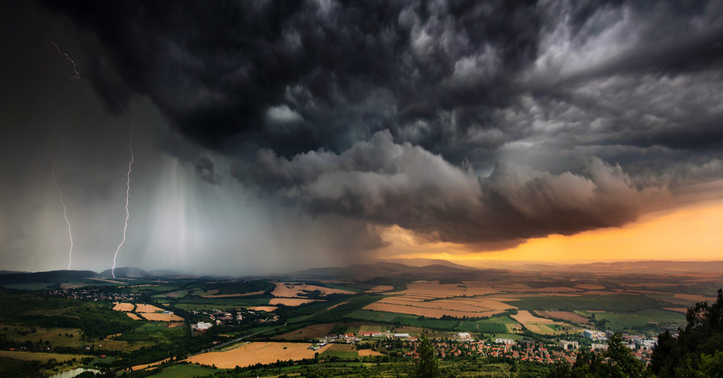
Weather events don’t need to make major news to have dangerous impacts. This makes it critical for businesses to understand weather hazards in their area and develop a risk management plan accordingly to keep their people and business safe.
Jonathan Erdman, Senior Digital Meteorologist at The Weather Channel, joined us on a recent episode of The Employee Safety Podcast to share his insights on weather risk management and strategies that businesses can adopt to improve weather preparedness.
You can listen to the full episode below.
My interest in meteorology started at the age of seven when I had a close encounter with a tornado that skipped over my house just after school. I later learned this tornado was surveyed by Dr. Theodore Fujita, whom the Fujita scale was named after. So my interest started early—it was fear and fascination at the same time. I studied physics at the University of Wisconsin and completed my master’s in atmospheric science at Colorado State University. You’d think after a tornado almost hit my house, I would make better choices for fieldwork, but this involved installing lightning rods near thunderstorms.
In 1998, I came to The Weather Channel as a forecaster and in 2010, I transitioned to Weather.com, where I produce videos and articles for The Weather Channel’s app and website that cover weather stories around the world. We cover everything from winter storms and hurricanes, to severe thunderstorms and tornadoes. Our forecast content is meant to alert our users about impactful weather.
I’ve been doing this for 23 years, and over that time I’ve covered over 150 Atlantic hurricanes, several hundred winter storms, and dozens of severe weather outbreaks. Among those was Hurricane Katrina. I was covering Katrina as a weather producer on The Weather Channel’s cable network, and I’ll never forget it. We were monitoring the imminent strike on the Mississippi gulf coast, but when the first National Weather Service flash flood warning came across announcing that there was a problem with the levee system, I felt helpless because there was nothing I could do at that point.
“"Know the types of weather hazards that can affect your area and have a system in place to communicate and alert your employees about these hazards."”Jonathan Erdman Senior Digital Meteorologist, The Weather Channel
The other event that comes to mind is the 2011 super tornado outbreak that occurred in Joplin, Missouri. This left a mark on me because of the number of violent, long-track tornadoes we saw that spring and the ferocity of the damage. There were mobile homes thrown 300 yards away, appliances shredded, entire homes missing, concrete slabs pulled out of the ground, and parking blocks scraped from the ground. The Joplin tornadoes stick with me more than anything because, despite the warnings that were issued, some of the public didn’t take shelter immediately. Instead, they looked outside and, because the violent tornado was hidden in a curtain of rain, what they saw looked like a rain shaft—it didn’t look like a tornado.
That’s the insidious part of the weather, and I don’t want to make anybody paranoid, but we’ve recently seen cases of flash flood events that are not associated with hurricanes or tropical storms. The most important thing I can pass along is that it doesn’t take a major newsworthy weather event to produce dangerous weather impacts. Flash flooding is the most underrated weather hazard out there. It can happen from just one or two slow-moving thunderstorms that happen to stall over your place of work or your home. The problem is these are not major events leading the nightly news as a hurricane would, yet you have people trying to drive through them. Most flood deaths occur in vehicles where someone attempts to drive through a flood, only to lose control and have their car picked up by the current. Other times, the roads have been washed away and cars just plunge right into the water. So, if your weather source puts out a flash flood watch, take caution and be aware that this type of thing can happen to you.
Lighting is another example of an overlooked risk. You think it’s something that won’t happen to you, but if you can hear thunder, you’re in danger of being struck by lightning. That’s a reliable rule of thumb. Another hazard that slips under the radar is light snow. Light snow doesn’t sound dangerous, but it doesn’t take a heavy snowstorm to make roads slippery. And if that one inch of snow happens to fall in less than an hour in what is called a snow squall, your visibility will go from clear to 100 yards or less, which can lead to deadly multi-vehicle accidents.
Know the types of weather hazards that can affect your area and have a system in place to communicate and alert your employees about these hazards. Ask yourself, how susceptible is your area to flash flooding? How susceptible is it to the occasional light snow? Austin is a perfect example of this—you may get one snowfall every couple of years, but when it does happen, it’s big. So you also have to think about infrequent events that can have big impacts and plan accordingly.
Those living in hurricane zones must also consider water because, while hurricanes are categorized based on wind impact, 88% of U.S. deaths from hurricanes and tropical storms are from water, not wind. So have plans in place to deal with the flooding, rainfall, and storm surge. Another thing to pay attention to is how fast or slow a hurricane is moving to help determine rainfall potential. As we saw with Hurricane Harvey in 2017, if a tropical cyclone stalls, rainfall and flood danger goes way up.
When I first started in meteorology, I was ripping forecast maps off of a dot matrix printer and printing satellite images (almost like Kodak film) from a huge blue box that would belch out a satellite image about every couple of hours. Today, however, our technology is amazing. We not only run sophisticated computer forecast models on supercomputers, but we can run each individual model several times with slightly different conditions. That’s called ensemble forecasting. Not only does this give you a forecast, but it gives you confidence in your forecast. For example, if you have 51 different versions of a model and you tweak the conditions a little bit and they all still say a hurricane is going to form and head toward Louisiana, you can have confidence in that forecast. But if half of the models don’t spin up a hurricane or half of them move toward Florida, then you know uncertainty is high. So ensemble forecasting, in my opinion, has been the biggest, most beneficial change in technology that I’ve seen over the years.
Doppler Radar has also been a game-changer for detecting rotation in thunderstorms and tornadoes. Conventional Radar detects rainfall, precipitation, and clouds. Doppler Radar detects the motion of raindrops in the clouds. So it detects motion toward the radar and away from the radar. In that way, it can detect rotation in thunderstorms that may or may not be associated with tornadoes. With the more recent Doppler radar technology, we can even detect lofted debris from tornadoes so that we can confirm there is a tornado in progress based on radar, not by sight. So, if we don’t have spotters out at night, for example, Doppler Radar can detect a tornado by the debris from trees, buildings, and anything else that tornado is impacting.
In general, be more weather aware. If you hear about the weather watch on your way to work, tell your coworkers and plan for what you would do if a flood, hurricane, or tornado were in your area. Finally, as I’ve learned from the school of hard knocks, dangerous weather can happen to you. So plan as if someday, unfortunately, severe weather may impact you.
AlertMedia, Risk Intelligence and Response


Please complete the form below to receive this resource.